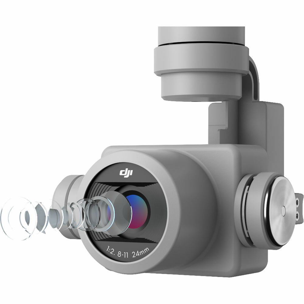
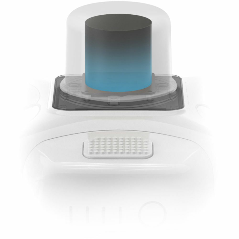
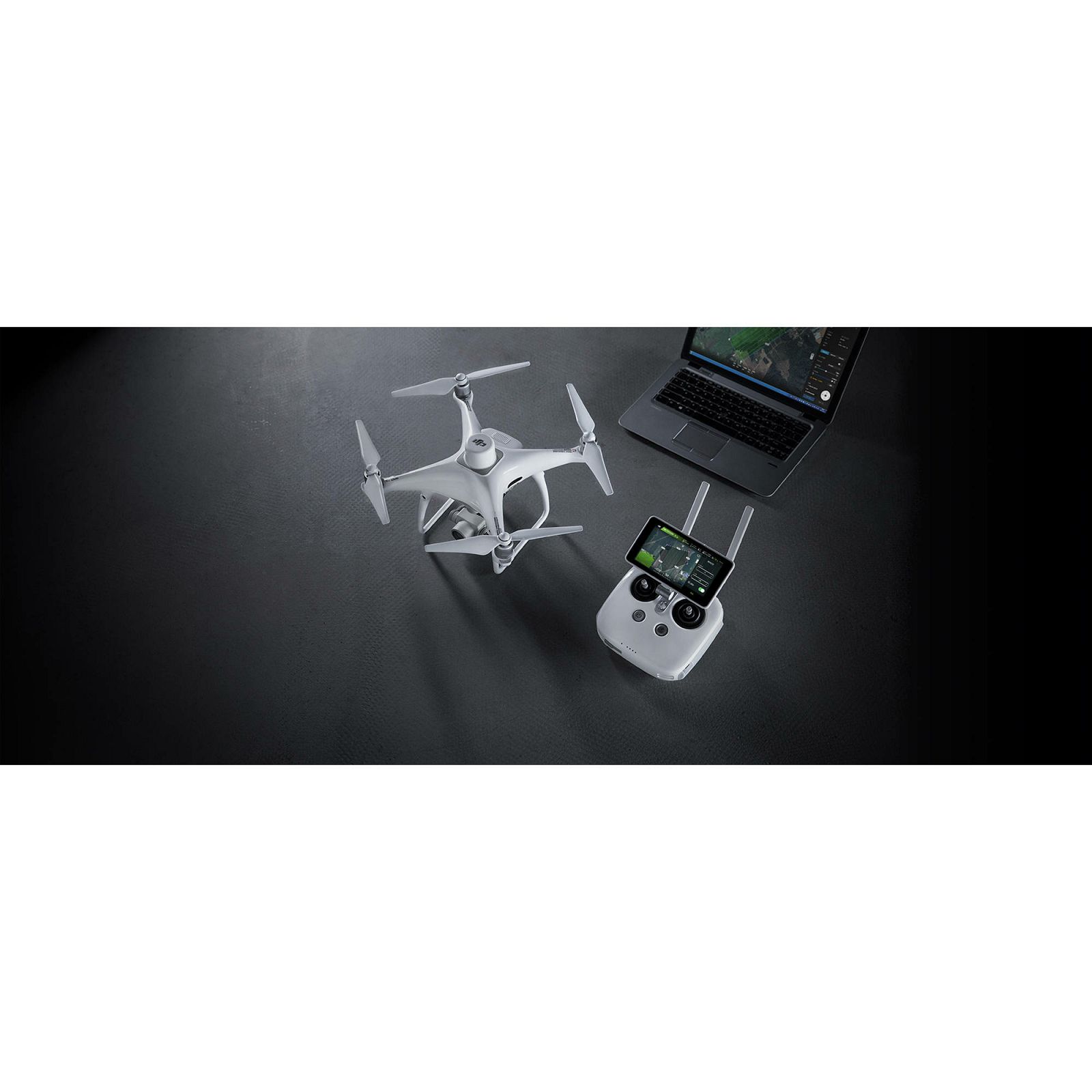
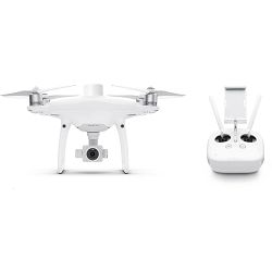
DJI Phantom 4 RTK + D-RTK 2 GNSS Mobile Station Combo dron Quadcopter (CP.TP.00000231.01)

DJI Phantom 4 RTK + D-RTK 2 GNSS Mobile Station Combo dron Quadcopter (CP.TP.00000231.01)
7.631,43 €
(Uključen PDV 25%)
Proizvod trenutno nije dostupan
Šifra: CP.TP.00000231.01
Dostupnost artikla: Naša stranica ne prikazuje raspoloživost ili dostupnost artikala. Dostupnost provjeravamo nakon zaprimljenog upita ili narudžbe
Jamstvo (mjeseci): 12
Ovo bi vas moglo zanimati …
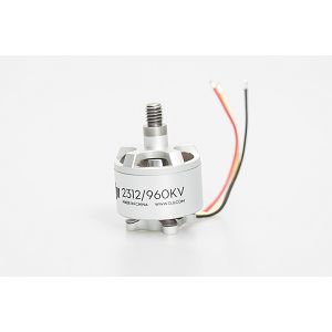
DJI 2312 Motor (CCW) Spare Part 11 rezervni motor za Phantom 2
DJI 2312 Motor (CCW) Spare Part 11 rezervni motor za Phantom 2 Counterclockwise Rotation Stator Size of 2312 For Phantom 2 Only The counterclockwise rotating 2312 Motor for Phantom 2 from DJI is one of two motor types the quadcopter uses -- two hav
30,39 €
(Uključen PDV 25%)
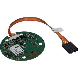
DJI Phantom 2 Spare Part 1 GPS Module Dron
DJI Phantom 2 Spare Part 1 GPS Module The GPS Module for Phantom 2 Quadcopter provides the aircraft's flight control system with essential satellite-based location data. GPS is required for many autopilot assisted features, includes Return to Home,
164,58 €
(Uključen PDV 25%)

DJI Goggles Racing Edition (CP.VL.00000014.01)
DJI Goggles Racing Edition (CP.VL.00000014.01) ZNAČAJKE: For DJI Aircrafts Full Flight Setting Control Two High-Resolution Screens Head Tracking Gimbal Control On-Screen Display Digital & Analog Transmission Facial Pad The DJI Goggles Racing Editi
591,81 €
(Uključen PDV 25%)
DJI Enterprise Shield Basic Phantom 4 RTK (CP.QT.00001801.01)
DJI Enterprise Shield Basic Phantom 4 RTK (CP.QT.00001801.01) ZNAČAJKE: This DJI Phantom 4 RTK Quadcopter with SDK Controller & Enterprise Shield Basic Kit from B&H includes the DJI Phantom 4 RTK Quadcopter with SDK Controller and the DJI Enterpris
626,12 €
(Uključen PDV 25%)
DJI Phantom 4 RTK + D-RTK 2 GNSS Mobile Station Combo dron Quadcopter (CP.TP.00000231.01)
7.631,43 €
